- Itinerary
- Day 1: Victoria to Nanaimo on “The Rotary Route”
- Day 2: Nanaimo to Porpoise Bay Provincial Park
- Day 3: Porpoise Bay to Powell River
- Bonus Day: Powell River to Lund & Back
- Day 4: Powell River to Nanaimo
- Bonus Day: Newcastle Island
- Day 5: Nanaimo to Salt Spring Island
- Day 6: Salt Spring Island to Victoria
- Maps & Route Directions
Overview
This ride takes you up the east side of Vancouver Island, across the Strait of Georgia and north up the Sunshine Coast, and then back to Vancouver Island and south again. The mileage is not particularly grueling, but the ferry logistics can eat up a lot of time. The route passes through many lovely towns, and if you have extra time, you can spend some bonus days enjoying the sites.
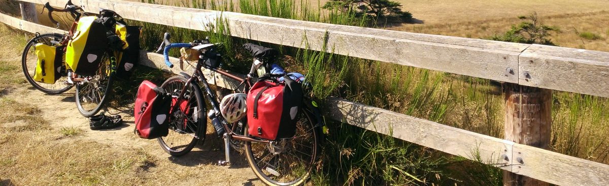
When I planned this ride, I scheduled a handful of 30 mile days. This was the trip where I learned that I will inevitably turn a 30 mile day into a 60 or 70 mile day. I ended up combining the riding on half of the days and site seeing on my free days. This change of plans was fortuitous when I ended up with a free day on Newcastle Island, a marine provincial park near Nanaimo that has a campground. I also appreciated having a day in Victoria at the end of the trip; when packing, you should to keep in mind that you might end up spending a day in the city.
This ride is not too challenging, but you do need to plan for the ferries and be aware of food locations. There are a couple of places on the route that do not include many restaurants or grocery stores, so you should keep some extra food with you just in case. I also recommend keeping an eye on when restaurants close, because I got to some just before closing and would have been out of luck had I shown up an hour later.
I did this ride in early June, which was great, because school was still in session and the campgrounds weren’t too full. On the other hand, it rained quite heavily every other day. As a result, I recommend doing this trip in late June or early July to maximize sunshine and minimize rain. The extra daylight around the summer solstice is also helpful when managing the ferry logistics. Because this is a coastal route, the climate is relatively temperate, giving you lots of flexibility when timing your trip.
Itinerary
Day 1: Victoria to Nanaimo on “The Rotary Route”
Today’s ride starts in Victoria and ends just south of Nanaimo at the Living Forest Oceanside Campground. I followed a map I found online, and the route was quite lovely, with a picturesque ferry in the middle.
Distance
Approx. 75 miles
This was one of the longer days of the trip, made even longer by taking a ferry in the morning, a second ferry mid-way through the ride, and then needing to stop to buy a new tire in the afternoon. Nevertheless, I got to the campground in plenty of time to set up my tent.
Logistics
Ferries
- To get to Victoria, I took the Victoria Clipper from Seattle. For $20, you can bring your bike on the ferry. The bikes are kept on the outside deck, and by the time I arrived, my bike had gotten enough salt water on it that it needed to be rinsed off to avoid rust. As a result, I’m no longer a fan of taking my bike on the Clipper, but it is still an option for traveling with bikes. For more information about bicycles on the Victoria Clipper, see the travel information page on the Victoria Clipper website.
- The afternoon route takes the Brentwood Bay to Mill Bay ferry. This ferry is small and departs approximately once an hour.
Food
- Lunch: By the time I got off the ferry, it was time for lunch. Luckily, the ferry drops you in the middle of downtown Victoria, so you have plenty of options for a quick bite to eat.
- Dinner: The Southgate shopping center is located right before the turn-off to the campground. When I did this trip, I found a lovely little sushi restaurant where I ate dinner. If you prefer to cook, there’s a Country Grocer grocery store near the park as well.
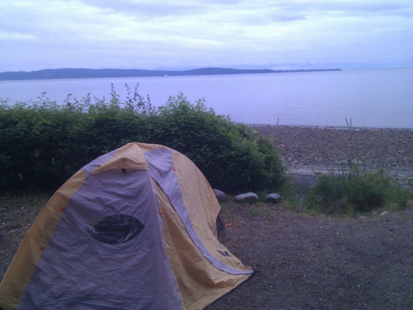
Camping
Living Forest Oceanside Campground
Day 2: Nanaimo to Porpoise Bay Provincial Park
Today includes a lot of time on ferries and less time on bikes. If you are highly motivated, you could catch the earlier, 8:25 AM ferry out of Nanaimo, start your day earlier, and get more riding in. There is something to be said for having a lazy morning when on vacation, though. Also, Porpoise Bay Provincial Park is really nice, and I recommend spending the night there. It also has some nice trails that you can explore while there if you arrive particularly early.
If you need more activities during the day, you can stop in the town of Roberts Creek and check out the Gumboot Cafe.
Distance
Approx. 25 miles
- 5 miles from the campground to the Departure Bay ferry terminal
- 20 miles from the Langdale Ferry Terminal to Porpoise Bay Provincial Park
Today is a short day of riding and a long day of ferries.
Logistics
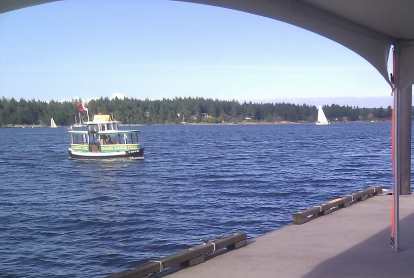
Ferries
Today includes two ferries, one of which is pretty long.
- Departure Bay to Horseshoe Bay (Nanaimo to Vancouver)
- Crossing time is 1 hour and 40 minutes.
- If you are an early riser, you could catch the 8:25 AM ferry. Otherwise, the 10:40 AM ferry is your best option. As always, check the schedule to verify times.
- Horseshoe Bay to Langdale
- Crossing time is 40 minutes.
- The 2:10 PM ferry is probably the latest ferry you would reasonably want to catch. As always, check the schedule to verify times.
Food
- Lunch: I recommend eating on the Departure Bay to Horseshoe Bay ferry. The BC ferries have pretty good food (when they have food), and the journey is more than long enough for lunch.
- Dinner: The town of Sechelt is not far from the campground. This town is a good place to grab dinner or to buy groceries to cook at the campsite. You will pass through Sechelt again tomorrow on your way back from the campground, when you should buy supplies for tomorrow’s lunch.
Camping
Day 3: Porpoise Bay to Powell River

Today starts in Sechelt, which has services, and ends in Powell River, which also has services. In between, you won’t find many services. Stock up for the day in Sechelt. Maybe start the day with a coffee and pastry at the local cafe, and then prepare for some hills.
You take one ferry mid-day. The ferry does not run often, and at the time that I was there, the area around the ferry terminal was pretty desolate, so know the ferry schedule and have plenty of food and water. This particular ferry did not sell food on board.
Distance
Approx. 56 miles
- 36 miles from Porpoise Bay Provincial Park to Earls Cove
- 20 miles from the Saltery Bay ferry terminal to Willingdon Beach Campsite
Logistics
Ferries
Today has one ferry, Earls Cove to Saltery Bay. The terminals are not near any towns, and the ferry probably doesn’t have food service, so don’t plan on eating at, on, or after the ferry, unless you bring the food yourself.
The crossing time is 1 hour. If you miss the 12:25 PM ferry, the next ferry doesn’t arrive until 4:55 PM. I recommend aiming for the 12:25 PM ferry. As always, check the schedule to verify departure times.
Food
- Lunch: Buy food in Sechelt to eat for lunch.
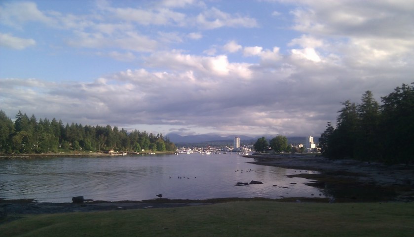
- Dinner: Powell River is a relatively big town with plenty of restaurant options. If you prefer to cook at camp, it also has grocery stores.
Camping
When I stayed here, this campground was a Municipal Park. I’m not sure what has changed or how it has changed, but I remember the campground as a really nice place to stay. I also remember a torrential downpour the night I stayed there. The campground is just outside Powell River, which is a bonus if you want to be near services, but a downside if you want to get away from it all.
Bonus Day: Powell River to Lund & Back
If you have an extra day, you can bike from Powell River to Lund and back, and spend a second night at the Willingdon Beach Campsite. You could also catch the ferry to Comox in the evening after returning from Lund and spend the night in Comox or Courtenay.
Lund is a quaint fishing and tourism town with lots of restaurants and activities. I can’t comment on the route or the town, because it was pouring rain the day I had planned to go to Lund, so I caught the ferry to Comox and spent the day in Courtenay instead. The distance to Lund and back is approximately 30 miles.
Day 4: Powell River to Nanaimo
Today has one ferry in the morning that takes you back to Vancouver Island, and possibly a foot ferry in the evening if you choose to camp on Newcastle Island. I recommend catching the early ferry to Comox so that you can start your ride early enough to enjoy the scenery along the way. Luckily, the ride from the campground to the ferry is only about one mile. Once you get to Vancouver Island, the roads get busier. The scenery is beautiful, but this section of the ride probably had the worst traffic of the trip.
When I did this route, it poured the night I spent in Powell River, and all of my camping gear was soaked the next morning. It continued to rain through the next day, so I decided to take the ferry to Comox and spend a night at a hotel in Courtenay. Courtenay is a great town with a lot to offer. I was then able to start this ride from Courtenay, which saved me a morning ferry ride, and gave me more time for biking. If you spend a bonus day visiting Lund, you could catch the ferry to Comox in the evening, and spend the night in Comox or Courtenay.
Distance
Approx. 77 miles
Logistics
Ferries
- Take the Powell River to Comox ferry in the morning to cross back to Vancouver Island. The ferry only runs four times a day, and the crossing takes an hour and a half. I recommend catching the earliest ferry, which currently departs at 8:05 AM, so that you have plenty of time to bike south to Nanaimo.
- If you choose to camp on Newcastle Island, which I recommend, you also take a foot ferry from Nanaimo to Newcastle Island. The ferry runs every half hour, but be sure to check the schedule to make sure the ferry is running when you plan to travel. The schedule changes depending on the season.
Food
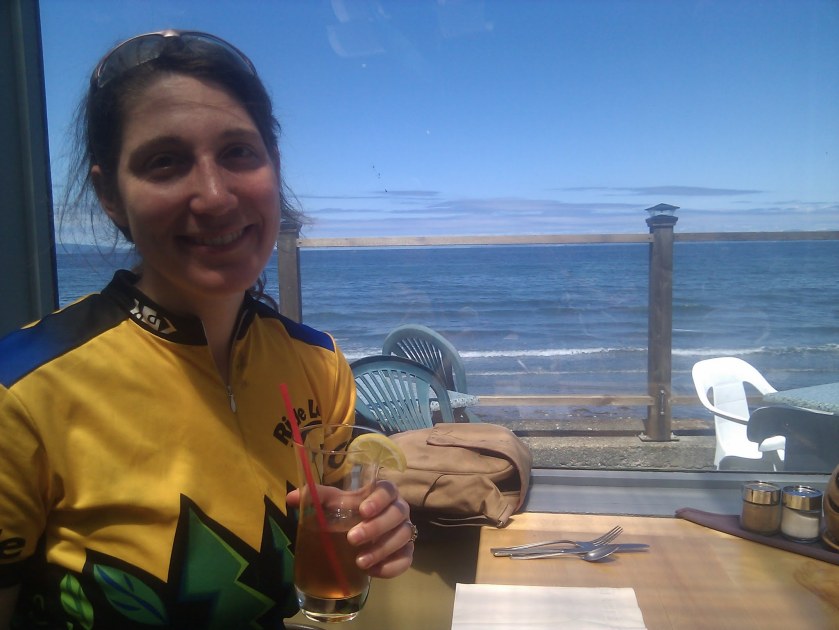
- Lunch: If you take the morning ferry, you might be ready to eat when you get to Courtenay. The restaurant that I went to in Courtenay is unfortunately now closed, but Vancouver Island is full of delicious food, so you shouldn’t have any trouble finding a good restaurant. If you want to ride a little farther before eating, you’ll find plenty of lovely restaurants along the coast. I stopped at a restaurant on the beach in Qualicum Beach and had a very scenic lunch.
- Dinner: Either eat dinner in Nanaimo, or buy groceries in Nanaimo for cooking at the campsite. When I visited, Newcastle Island had a small store with very limited food options (mainly ice cream). Be sure to bring whatever you need to eat with you to the island. If you visit during the high season, you might now be able to have dinner on Newcastle Island, but be sure to check the concessions section of the website to confirm.
Camping
Newcastle Island is a gem just off the coast of Nanaimo. Cars are not allowed on the island, nor are predators, resulting in a large deer population. The island is also known for its albino raccoons, so be sure to store your food in the raccoon bins provided by the park.
If you don’t want to spend the night on Newcastle Island, you could camp at Living Forest Oceanside Campground, about 5 miles south of Nanaimo.
Bonus Day: Newcastle Island
A lovely walking trail circumnavigates Newcastle Island. If you have an extra day, I recommend spending it here. During my visit, amenities on Newcastle Island were very limited, but it looks like they now offer some concessions during the high season. I recommend confirming that the concessions are open before relying on them and bringing extra food just in case.
Day 5: Nanaimo to Salt Spring Island
A tour in this region would not be complete without a trip to one of the Gulf Islands. Salt Spring Island is a particularly good choice, because it has a lovely little town with tasty food and an exceptional campground.
Distance
Approx. 45 miles
- 30 miles from Nanaimo to the Crofton ferry terminal
- 15 miles from the Vesuvius ferry to Ruckle Provincial Park
Logistics
Ferries
- If you spend the previous night on Newcastle Island, you start your day by catching the foot ferry back to Nanaimo. The ferry runs every half hour during the peak season, but be sure to check the schedule.
- To get to Salt Spring Island, take the Crofton to Salt Spring Island ferry. Ferries depart about every hour and fifteen minutes, and the crossing time is 25 minutes.
Food
- Lunch: You can grab a bite to eat in Crofton, which might be a good way to kill time while waiting for the ferry. If, however, you arrive at the ferry terminal right in time to catch a ferry, there are plenty of lunch options on Salt Spring Island, and the bike route takes you past a few of them. You might also be hungry before getting to Crofton, in which case, there are plenty of restaurants between Nanaimo and Crofton.
- Dinner: While biking through Salt Spring Island, stop at a grocery store mid-way through the ride to pick up food to cook at the campsite.
Camping
Ruckle Provincial Park *no showers*
The downside to this campground is that it does not have showers. However, I’ve been told by a friend who has “showers” as her non-negotiable criteria for campgrounds that this campground is so nice that it’s worth staying here even without showers.

Day 6: Salt Spring Island to Victoria
This final day ends in Victoria, which is a great city for site seeing and afternoon tea. Alternately, you could catch a ferry from Salt Spring Island to Vancouver, and take a train from Vancouver. The Amtrak Cascades line allows bikes in the baggage car, and an increasing number of Amtrak routes allow you to bring a bike without boxing it.
Distance
Approx. 29 miles
- 5.5 miles from Ruckle Provincial Park to Fulford Harbour
- 23 miles from Swartz Bay to downtown Victoria
Logistics
Ferries
The day starts with a ferry trip from Fulford Harbour to Swartz Bay. The ferry leaves approximately every two hours, and the crossing time is 35 minutes.
Food
Food on this route is no problem. The entire ride passes through pretty populated areas, and the route is short enough that you should be able to have dinner in Victoria.
Lodging
If you decide to end the trip in either Victoria or Vancouver, plan to stay at a hotel instead of camping. Booking ahead of time might be a good idea. Victoria is also an excellent place to spend a bonus day site seeing.
Maps & Route Directions
The only trouble with this route is the lack of one good map to follow the whole way. I pieced the route together from maps and route directions that I found online. You can find additional maps for Vancouver Island on the Cycle Vancouver Island website.
Day 1: Victoria to Nanaimo
I followed “The Rotary Route” map. The only trouble I had was finding the beginning of the Galloping Goose trail. The map itself starts in Sidney, but I followed the alternate route from Victoria. After that, it was a breeze.
- Head southwest on Ferry Ramp toward Belleville St
- L Belleville St
- L Government St
- L Wharf St
- L to stay on Wharf St
- L Johnson St
- R toward Harbour Rd (first R after bridge)
- Continue straight onto Harbour Rd
- R onto Galloping Goose trail (1.3km)
- Slight left to stay on Galloping Goose trail
- Slight right to stay on Galloping Goose trail (1.4 km)
- L toward Lochside Regional trail
- L onto Lochside Regional trail
- Continue onto Galloping Goose trail (1 km)
- R toward Interurban Rd
- Slight R at Interurban Rd
- R toward Interurban Rd
- L onto Interurban Rd (6 km)
- L Goward Rd
- Slight right onto Interurban Rd (1.9km)
- R Prospect Lake Rd
- Continue straight onto Interurban Rd (1.6km)
- L Wallace Dr (4.6 km)
- L Hagan Rd
- L Clarke Rd
- R Brentwood Dr
- L Verdier Ave
- L Ferry Ramp
- Follow Mill Bay Road from the ferry bearing right. You are now heading north (5km)
- Intersection of Mill Bay Road and Deloume Road: large shopping center on your left
- R Trans Canada Highway (1.8km)
- R Kilmalu Road east a short distance to Telegraph Road (.6km)
- L Telegraph Road (6 km)
- R Cherry Point Road. You have a brief jog to the east and you are heading towards the water at Cherry Point Beach. (1 km)
- Bear left on Cherry Point Road at intersection with Garnett Road (5.5 km)
- R Cowichan Bay Road (4.7 km)
- Straight through intersection onto Tzouhalem Road (South Cowichan Lawn Tennis Club/Intersection Cowichan Bay Road/Tzouhalem Road) (6 km)
- R Maple Bay Road (6 km)
- L Herd Road (on downhill; easy to miss) (3 km)
- R Osborne Bay Road (5 km)
- L Chaplin Street (0.3 km)
- R Crofton Road (3 km)
- Bear R: Crofton Road becomes Chemainus Road (10 km)
- R Trans Canada Highway (20 km)
You will need to detour off the Trans Canada Highway to get to the campground.
Day 2: Living Forest Oceanside Campground to Porpoise Bay Provincial Park
- From the campground, return to the Trans Canada Highway and head north. Take the highway to the Departure Bay ferry terminal.
- Take the Departure Bay to Horseshoe Bay ferry, and then take the Horseshoe Baye to Langdale ferry.
- L Marine Drive (into lower Gibsons) (5 km)
- R School Rd
- L Gower Point Rd
- R Pratt Rd
- R Grandview Rd
- L Pratt Rd
- L Sunshine Coast Hwy (3 km)
- L Lower Rd (6 km) to Roberts Creek (food, groceries, Dinner at Gumboot?)
- L Roberts Creek Rd (quick)
- R Beach Ave (2 km)
- R Flume Rd
- L Sunshine Coast Hwy to Sechelt
- R Xenichen Ave
- R E Porpoise Bay Rd
- Continue onto Sechelt Inlet Rd to Porpoise Bay Provincial Park
Day 3: Porpoise Bay Provincial Park to Willingdon Beach Campsite
- Leave the Park heading S on Sechelt Inlet Rd. Continue onto E Porpoise Bay Rd.
- L Xenichen Ave
- R Sunshine Coast Hwy (7km)
- L Redroofs Rd (11 km)
- L Sunshine Coast Hwy (to Ruby Lake Resort and the Earls Cove to Saltery Bay ferry)
- Take the ferry from Earls Cove to Saltery Bay. Wait for the cars to unload before riding.
- From Saltery Bay ferry terminal continue onto Sunshine Coast Hwy/BC-101 N
- L Forge Rd
- Return to Sunshine Coast Hwy and continue to Powell River
- Bike through Powell River to Willingdon Beach Campsite
Day 4: Willingdon Beach Campsite to Nanaimo
- From Willingdon Beach Campsite, go south to the Westview ferry terminal in Powell River. Take the ferry to Comox.
- From the ferry ramp in Comox, continue onto Ellenor Rd (1.7 km)
- Continue straight onto Anderton Rd (5.8 km)
- R Comox Ave (4.2 km)
- L 17 St/BC-19 Alt S
- L Riverside Ln, Continue onto Courtenay Riverway
- L Mansfield Dr
- L Cliffe Ave/BC-19 Alt S
- Slight right to stay on Cliffe Ave/BC-19 Alt S (73.3 km)
- L Franklins Gull Rd
- R NW Bay Rd (9.6 km)
- L BC-19 S (10.8 km)
- L Island Hwy/BC-19A S (3.9 km)
- R Mostar Rd (quick)
- L onto Trail
- Left toward Island Hwy/Terminal Ave N/BC-19A S
- Slight right onto Island Hwy/Terminal Ave N/BC-19A S
- R Comox Rd (110 m)
- R Wallace St (17 m)
- R and R again toward Harbourfront Walkway
- Continue straight onto Harbourfront Walkway to ferry
Day 5: Nanaimo to Ruckle Provincial Park
- From the ferry, return to Island Hwy/Trans-Canada Hwy/BC-1 S
- L onto Cedar Rd (3.0 km)
- R to stay on Cedar Rd (3.0 km)
- Slight right to stay on Cedar Rd (2.3 km)
- L to stay on Cedar Rd (6.5 km)
- L onto Island Hwy/Trans-Canada Hwy/BC-1 S (signs for Victoria) (3.4 km)
- Slight L onto Rogerson Rd (79 m)
- R to stay on Rogerson Rd (400 m)
- Continue onto Rockey Creek Rd (1.5 km)
- R onto 1 Ave (170 m)
- L onto Island Hwy/Trans-Canada Hwy/BC-1 S (signs for Trans-Canada Highway) (3.0 km)
- L onto Chemainus Rd/BC-1A S (71 m)
- R to stay on Chemainus Rd/BC-1A S (10.3 km)
- At the roundabout, continue straight to stay on Chemainus Rd/BC-1A S (4.7 km)
- L onto Crofton Rd (3.6 km)
- Slight L onto Chaplin St (650 m)
- Continue onto Ferry Ramp. Take the Crofton – Salt Spring Island ferry.
- Departing the ferry on Salt Spring Island, head north on Ferry Ramp toward Vesuvius Bay Rd (59 m)
- R onto Vesuvius Bay Rd (3.5 km)
- R onto Lower Ganges Rd (3.7 km)
- R onto Fulford Ganges Rd (4.0 km)
- Slight L onto Cusheon Lake Rd (2.2 km)
- R onto Stewart Rd (3.5 km)
- R to stay on Stewart Rd (21 m)
- L onto Beaver Point Rd (6.1 km)
Day 6: Ruckle Provincial Park to Victoria
Ruckle Provincial Park to Fulford Harbour Ferry Terminal
- Head southwest on Beaver Point Rd toward Forest Ridge Rd (6.1 km)
- L to stay on Beaver Point Rd (2.4 km)
- R to stay on Beaver Point Rd (110 m)
- Continue straight onto Fulford Ganges Rd
- Turn L toward Fulford Ganges Rd (34 m)
- Slight R onto Fulford Ganges Rd (250 m)
- Slight R at Morningside Rd (95 m)
Swartz Bay Ferry Terminal to Victoria
- R toward Lands End Rd (700 m)
- L onto Lands End Rd (230 m)
- R onto Curteis Rd (130 m)
- Continue onto Swartz Bay Rd (1.2 km)
- L onto McDonald Park Rd (950 m)
- R to stay on McDonald Park Rd (800 m)
- Continue onto Ardwell Ave (100 m)
- R toward Lochside trail (1.4 km)
- Slight R toward Lochside trail (350 m)
- Slight L onto Lochside trail (1 km)
- Sharp right onto Weiler Ave (45 m)
- R onto Patricia Bay Hwy/BC-17 S (5.6 km)
- L onto Mt Newton Cross Rd (21 m)
- Turn right (28 m)
- Turn left (49 m)
- Sharp R toward Lochside Dr (1.7 km)
- Continue straight onto Lochside Dr (5.6 km)
- L onto Cordova Bay Rd (350 m)
- R onto Lochside Dr (45 m)
- L to stay on Lochside Dr (2.3 km)
- R at Maplegrove St (230 m)
- Continue straight onto Lochside Dr (1.2 km)
- Continue onto Lochside Regional Trail (3.0 km)
- R onto Cedar Hill Cross Rd (87 m)
- L onto Borden St (180 m)
- R onto McKenzie Ave (13 m)
- L onto Lochside Regional Trail (290 m)
- Slight left to stay on Lochside Regional Trail (1.7 km)
- Slight left onto Galloping Goose Trail (42 m)
- Slight left to stay on Galloping Goose Trail (1.1 km)
- Slight right to stay on Galloping Goose Trail (350 m)
- Slight left to stay on Galloping Goose Trail (850 m)
- Slight left to stay on Galloping Goose Trail (800 m)
- L onto Harbour Rd (450 m)
- Slight L toward Esquimalt Rd (150 m)
- L onto Esquimalt Rd (100 m)
- Continue onto Johnson St (130 m)
- R onto Wharf St (120 m)
- R to stay on Wharf St (500 m)
- Keep R at the fork
- Continue onto Government St
