Overview
This trip can be customized to fit the amount of time that you have to tour:
- If you have a car, you can drive directly to Anacortes and spend a weekend touring two or three islands. If you drive to Anacortes, you can park on the residential streets for up to 72 hours and bike to the ferry terminal.
- You can bike to the islands from Seattle, taking an extra day or two to explore the Kitsap and Olympic peninsulas and Whidbey Island.
- You can take the Puget Sound Express passenger ferry from Port Townsend to Friday Harbour and skip Whidbey Island.
- For a longer trip, explore more islands, or spend extra time on each island.
I start the trip on a Saturday to minimize the number of weekend evenings spent at campgrounds, hoping for smaller crowds. During peak summer months, the hiker/biker sites can be popular. I usually do this trip in five days, biking north from Seattle and then visiting two of the San Juan islands. To get home, I take a bus from Mount Vernon to Seattle.
I like to do this trip in August, when the weather is good, meteor showers are likely, and Orcas are common.
Itinerary
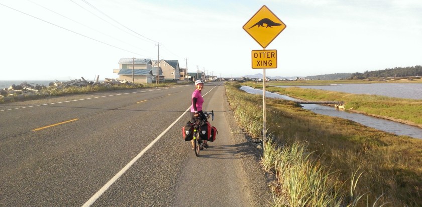
Day 1: Seattle to Deception Pass State Park

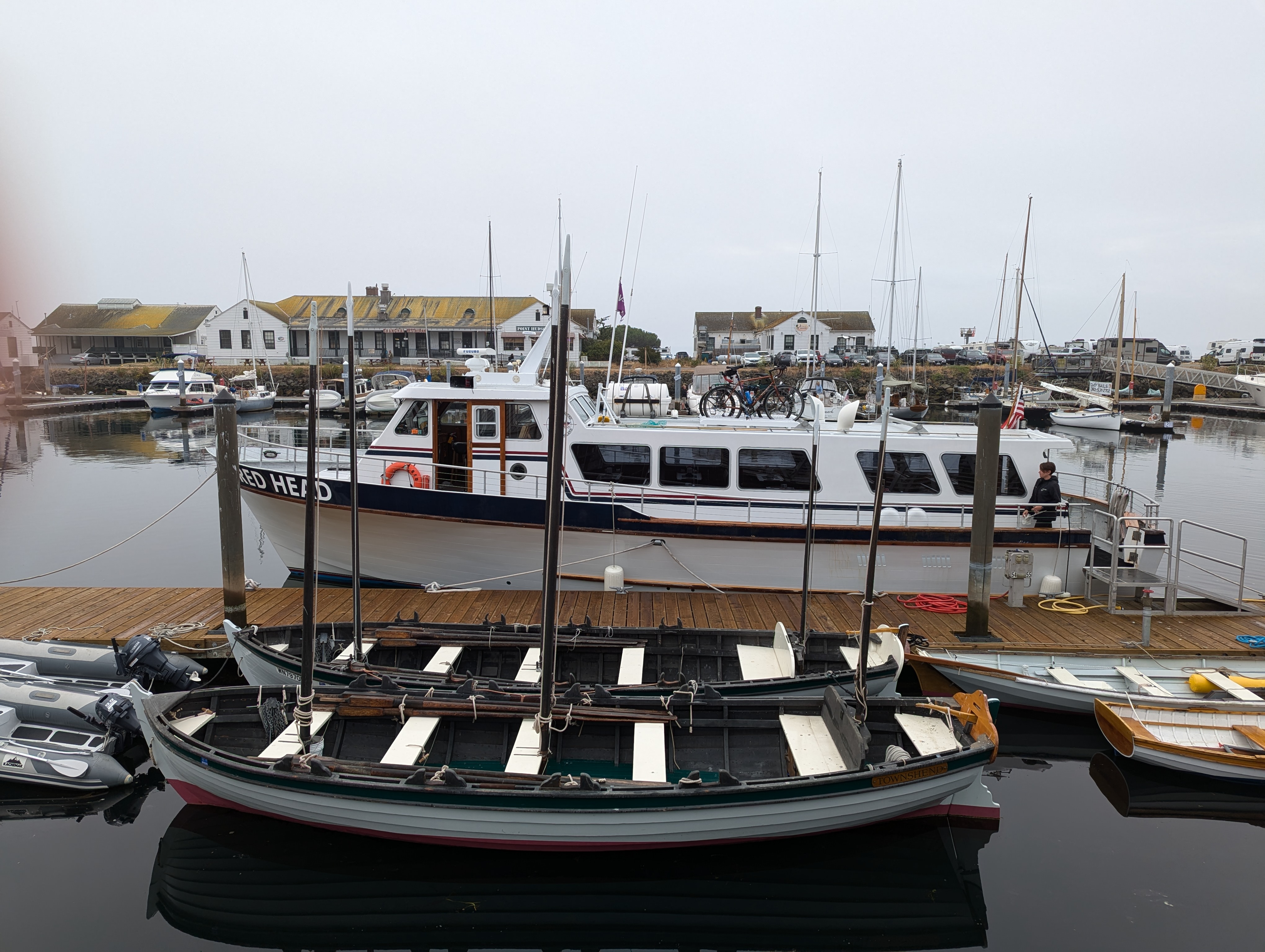
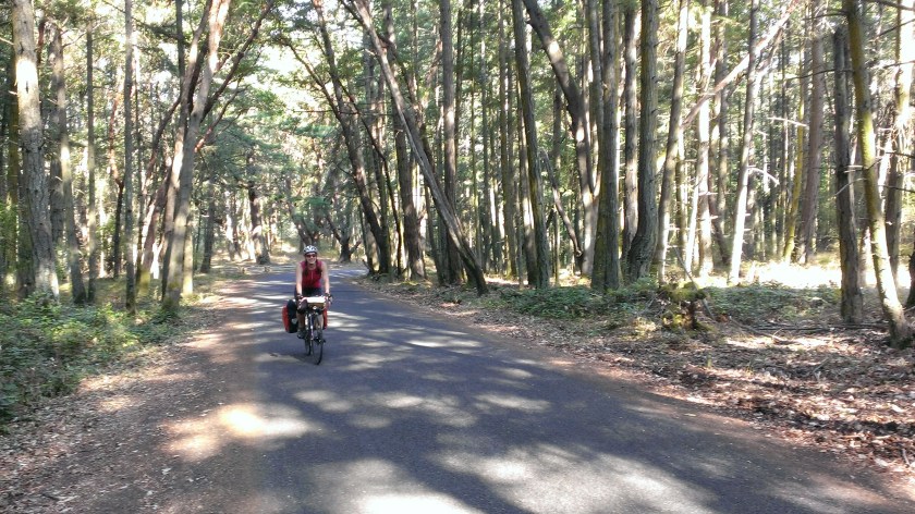
This day is long, but full of great riding and scenery. Port Gamble is adorable and has great food. Biking into Port Townsend is one of my favorite five (or so) miles in the region. I also love riding the north section of Whidbey island.
Distance
Approx. 80 miles
This day is particularly long, and the distance might not be appropriate for everyone. Luckily, there are great campground options near Port Townsend and Coupeville, so you can easily spread this ride over two days. If you take the Kitsap fast ferry from Seattle to Kingston, you can trim about 10 miles from the day.
Logistics
Ferries
- Kingston Fast Ferry
- Skip Bainbridge and go straight from downtown Seattle to Kingston.
- The ferry runs every weekday, and in the summer, it might also run on Saturdays.
- Bainbridge Ferry
- Common departure times: 8:55 AM, 9:35 AM
- But check the schedule!
- Port Townsend Ferry
- Common departure times: 1:15 PM, 2:00 PM, 2:45 PM, 3:30 PM, 4:15 PM, 5:15 PM, 6:45 PM
- But check the schedule! It’s not uncommon for one of the ferries to be out of commission, so departures might be cancelled day of.
- Puget Sound Express
- Departs at 9:00 AM from Port Townsend. Arrive at 8:30 AM.
Food
- Lunch: Butcher and Baker Provisions is a fantastic restaurant in Port Gamble that shouldn’t be missed. The wait can be long, but if you order ahead online, your food is ready when you arrive.
- Dinner: There isn’t food, not even a grocery store, near Deception Pass State Park, so buy groceries in Coupeville and plan to make dinner at the campground.
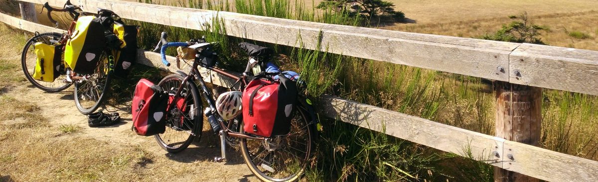
Camping
Alternate camping options if you want to make this a two-day ride. The first two campgrounds in the list are in or near Port Townsend, and are good places to spend the night if you decide to take the Puget Sound Express passenger ferry from Port Townsend to Friday Harbour.
- Fort Townsend
- Fort Worden
- Fort Flagler (a bit of a detour)
- Fort Ebey
- Fort Casey – This campground might be windy, and I can’t vouch for the quality of the hiker/biker sites.
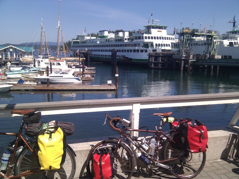
Day 2: Deception Pass to Orcas Island
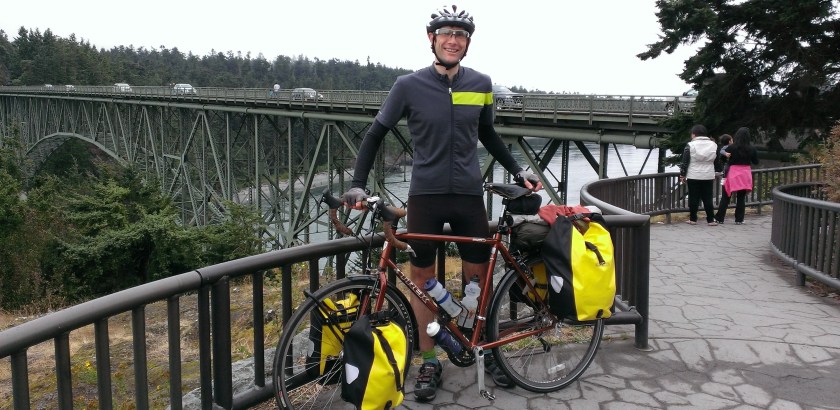
Riding through Deception Pass can be a little stressful, because there are lots of cars, winding roads, and sometimes very small shoulders. Still, it’s beautiful and worth it. My favorite part of this ride is the Tommy Thompson Trail going into Anacortes. When you ride over the water, keep an eye out for seals.

Orcas Island is stunning. Eastsound is a beautiful spot to stop and eat, with decent restaurants and a great bakery. The island has a reputation for being hilly, but you can avoid the worst of the hills, and the rest aren’t too bad. For an extra adventure, you can bike to the top of Mount Constitution. I did it once, and I think that was enough.
The hiker/biker sites in Moran State Park used to be really peaceful and well spaced out, but in recent years, they converted part of the forest into a parking lot, and some of the hiker/biker sites into car walk-in sites. Last time I was there, it was very noisy, people were pirating the walk-in sites, rangers were trying to catch the people, no one was in their assigned site, and I think adding the walk-in sites was a mistake.
Distance
Approx. 40 miles
- About 20 miles from Deception Pass to Anacortes
- About 20 miles on Orcas
Logistics
Ferry
Anacortes to Orcas Island Ferry
- Common departure times: 10:20 AM, 12:35 AM, 3:45 PM
- But check the schedule!
Food
- Gere-a-Deli in Anacortes has tasty sandwiches and cakes, but is often closed when I’m in Anacortes.
- Alternately, there are two grocery stores in Anacortes where you can buy food for lunch and/or dinner.
- Some ferries have food, but sometimes the kitchens are closed, so don’t count on buying food on the ferry.
- On Orcas Island, East Sound has restaurants, grocery stores, and a delicious bakery, Brown Bear Baking. I usually buy groceries in East Sounds and make dinner at the campground.
Camping
If you have time and want an extra adventure, you can bike from the campsite to the top of Mount Constitution. It starts out pretty challenging, but gets easier as you get closer to the top. There’s also a lake that you can swim in.
Day 3: Orcas Island to San Juan Island
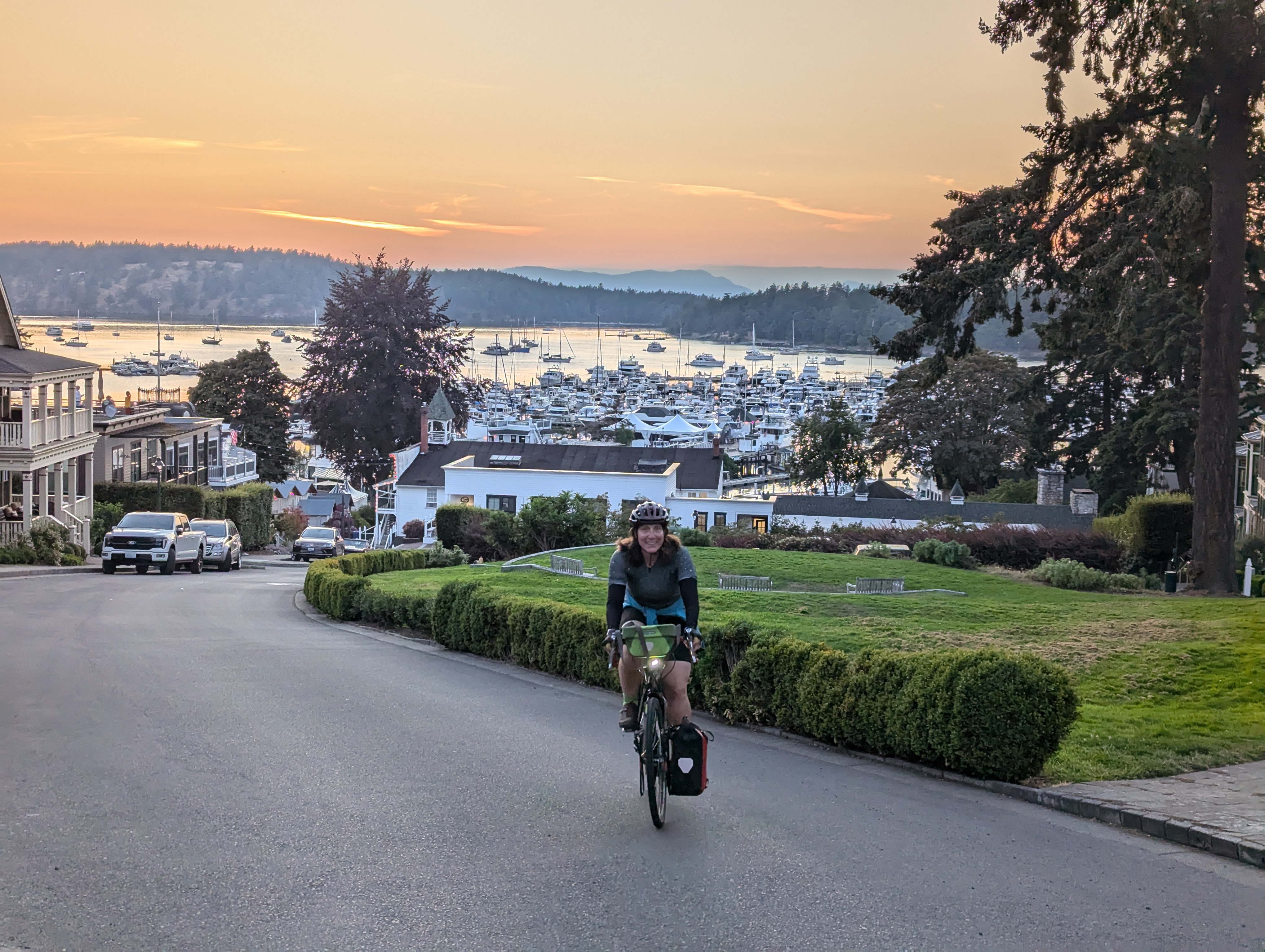
San Juan Island is my favorite of the islands. It has beautiful parks, the best camp ground in the region, and it’s not uncommon to see Orcas swimming off the west side of the island.
Distance
Approx. 40 miles, depending on detours
- About 20 miles on Orcas
- About 15 miles on San Juan Island, more if you detour to American Camp
Logistics
Ferry
Orcas Island to San Juan Island Ferry
- Common departure times: 10:40 AM, 12:25 AM, 4:25 PM
- But check the schedule!
Food
- The morning ride to the ferry is a great opportunity to stop at Brown Bear Baking, if you leave yourself enough time.
- Friday Harbor has a grocery store where I usually buy food for a picnic lunch at American Camp and dinner.
Camping
San Juan County Park *no showers*
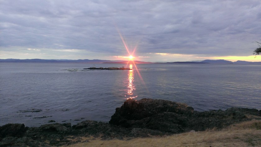
San Juan County Park is one of my favorite camp sites. It’s not uncommon to see the Orcas swimming past, the sunsets are beautiful, and I often see meteor showers at night. One caveat: there are no showers at the campground, but you can bike to Roche Harbour, where they have coin operated showers. Bring enough quarters, because the Roche Harbour showers are a little spendy.
Recommendations
American Camp and English Camp are both beautiful historical sites. I recommend visiting both. Though I prefer American Camp, English Camp has nice walking trails. Roche Harbor gets mixed reactions from cyclists, but I enjoy the showers and the scenery. It’s a nice spot to have dinner and a shower, if you don’t mind the yachting crowd.
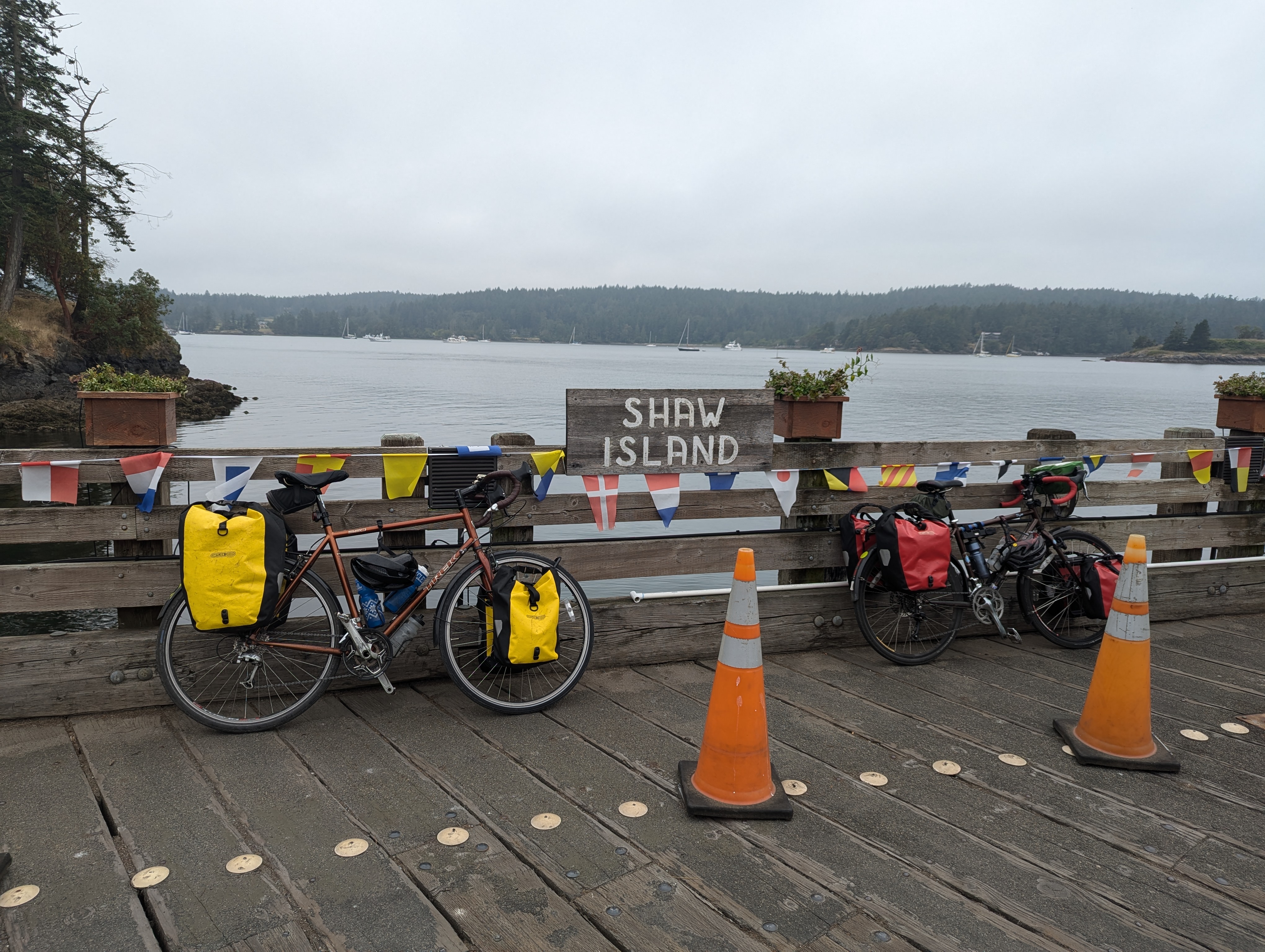
Day 4: San Juan Island to Shaw Island
The second half of San Juan Island is almost as nice as the first. This part takes you past English Camp and Roche Harbor, and it’s probably worth taking some time to stop and see the sites. If you go from San Juan Island to Shaw Island, I recommend taking your time on San Juan island to enjoy the campground and explore the parks.
Shaw Island is small, and the campground is only two miles from the ferry. You can arrive on the island late in the day and still have plenty of time to set up camp and eat dinner. Shaw island has one general store near the ferry and not much else, so plan ahead for food.
Distance
Varies depending on the detours you take on San Juan Island and how much riding you choose to do on Shaw Island, but if you just ride the second half of San Juan Island and then go straight to the campground on Shaw, it’s about 17 miles.
Logistics
Ferry
San Juan Island to Shaw Island Ferry
- Common departure times: 8:30 AM, 11:35 AM, 2:20 PM, 5:45 PM
- But check the schedule!
Food
- Plan ahead! You can bring food for a picnic lunch in one of the parks if you have time.
- You can eat at the restaurants at Roche Harbor.
- I often buy a sandwich at the Spring Street Deli in Friday Harbor to eat on the ferry. A word of warning: the deli can get really busy around ferry departures and arrivals. Make sure you have time to wait, or try to avoid the crowds.
- For Shaw Island, buy groceries in Friday Harbour on San Juan Island.
Camping
Shaw County Park *no showers*
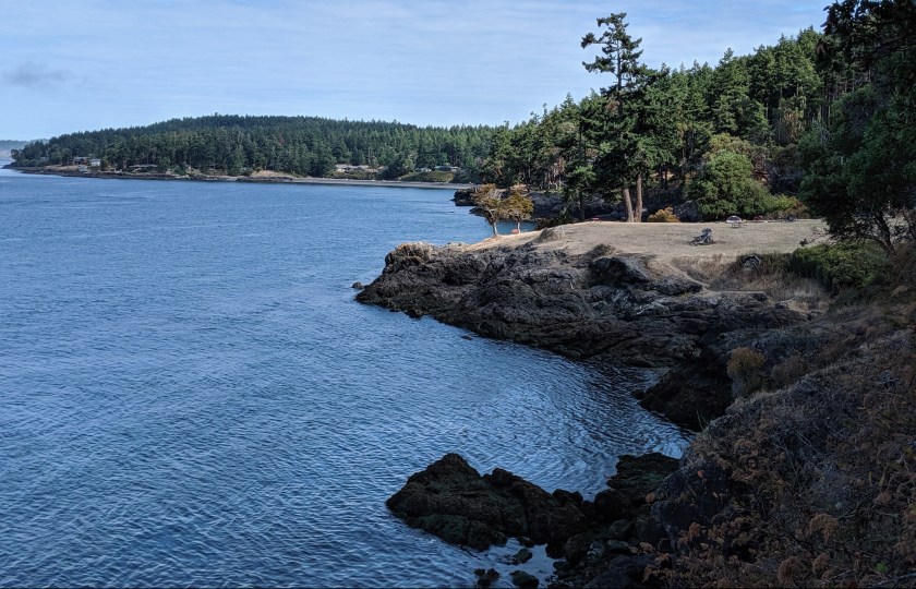
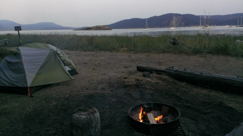
Shaw County Park is an excellent campground. The island is small, so you don’t have far to bike, and the Shaw County Park campground is quieter than the others and very scenic. The beach by the campground is small, but there’s a hiking trail through the woods that provides a nice break from cycling. The campground has a hiker/biker site, but the regular sites also get last minute cancellations. If you want your own site, when you arrive, ask if they’ve had any cancellations.
Day 5: Shaw Island to Lopez Island
Lopez Island is my least favorite of the islands, and the one I would skip if I needed to shorten the trip. I do like camping at Spencer Spit State Park *if* I can manage to reserve on of the sites on the spit. Otherwise, I might skip this island altogether. The food is usually disappointing, apart from the bakery, which is often closed, and the riding is the dullest of any of the islands. Lopez has a reputation as being a great place to bike, and I think that’s because it’s flatter than the other islands. Hills can be challenging, but just because the ride is flatter doesn’t mean it’s better.
Distance
Varies depending on whether you come from San Juan Island or Shaw Island. The route on Lopez is about 36 miles.
Logistics
Ferry
Shaw Island to Lopez Island Ferry
- Common departure times: 9:30 AM, 12:20 PM, 3:25 PM
- But check the schedule!
Food
- I am not a fan of the restaurants on Lopez Island. Holly B’s Bakery is fantastic, and you should stop there if you get the chance, but don’t count on it being open. Even if it is open, if you arrive close to closing, most things could be sold out.
- Lopez Island has a great grocery store. I recommend buying supplies and cooking dinner at camp.
Camping
Option 1: Spencer Spit State Park *no showers*
The campsites on the spit are amazing. I always try to reserve one, but they book up far in advance. One of the advantages of starting this trip on a Saturday is that it pushes the Lopez Island night to the middle of the week, when the best campsites are more likely to be available. The rest of the camp sites are in the woods, and there are a lot of mosquitoes. I’m not a fan of those sites. Also, there are no showers at this campground.
Option 2: Odlin County Park *no showers*
Alternately, you can stay at Odlin County Park. The hiker/biker sites in this campground are in a great location with water views. However, there are also no showers at this campground. My issue with this campground is that to me, it always smells strongly of port-o-potties, and that really damages my enjoyment of my time there.
Recommendations
If you are desperate for a shower, there are public showers in Lopez Village.
Day 6: Lopez Island to Mount Vernon and Onward
I spent many trips trying to find a good bike route from Anacortes back to Seattle, and I’ve finally found one. However, a few years ago I started taking a bus back from Mount Vernon, and the bus ride can be an easy way to end the trip.
The riding in Skagit County is beautiful, so if you want more miles, today provides a great opportunity to ride in this region.
If you prefer not to take the bus, you can add an extra day to this trip and ride from Anacortes to Fort Townsend State Park one night. The next day, bike from Fort Townsend State Park to Kingston, and take either the Kingston to Edmonds ferry or the Kingston Fast Ferry to downtown Seattle. From Edmonds, you can take the Interurban trail back to Seattle. For the ride from Anacortes to Fort Townsend, follow the same route you took up, using the Adventure Cycling Washington Parks Section 1 route map.
Distance
Approx. 20 miles, more if you decide to explore Skagit County
Logistics
Ferry
Lopez Island to Anacortes Ferry
- Approximate departure times: 10:45 AM, 2:40 PM
- But check the schedule!
Buses
Recently, I’ve been taking the Greyhound or Amtrak Cascades bus back to Seattle. I’ve look into taking the Amtrak Cascades train, but the timing has never worked out. Both the bus options allow at least two bikes, and the Amtrak Cascades bus had a bike rack on front. The timing isn’t very flexible for these buses, but the ride is quiet relaxing.
Other transit options: Mount Vernon to Everett Station
- Skagit County Connector, Route 90X
- Skagit Station, 105 E Kincaid St, Mt Vernon
- Approximate departure times: 2 PM, 3 PM, 4:15 PM, 4:30 PM, 5:25 PM, 6:25 PM (last departure)
- But check the schedule!
Everett Station to Seattle
- Route 512, Bay C1, Everett Transit Station
- Departs multiple times per hour
Food
The Skagit Valley Food Co-op in Mount Vernon is a nice place to get lunch while you wait for the bus.
Maps & route directions
For this trip, I use the Adventure Cycling Washington Parks Section 1 route map, which takes you from the portion of the ride that starts on the Olympic Peninsula to Anacortes and all around the islands. This map is almost all you need.
The gap is the Bainbridge Island ferry terminal through the Kitsap Peninsula to the Olympic Peninsula. Luckily, Google Maps provides a perfectly good route for this section. My one piece of advice is that, as tempting as it might be to try to ride along the water, the road through the middle of the Kitsap Peninsula is actually better for riding.
For alternate routes around the islands, Biking Puget Sound has riding directions for all the islands.
I don’t remember where the route directions I have below came from, but here are the written directions that I use.
Bainbridge Island Ferry to Olympic Peninsula
- From the ferry, R onto Winslow Way E – 0.2 miles
- L onto Ferncliff Ave NE – 1.7 miles
- L onto NE Lofgren Rd – 0.3 miles
- R Moran Rd NE – 0.4 miles
- R N Madison Ave NE – 1.8 miles
- L NE Day Rd – 0.8 miles
- R onto WA-305 N Ferry Dock Olympic Dr SE – ~3 miles
- R onto Suquamish Way NE – 1.3 miles
- L onto Division Ave NE – 0.4 miles
- L NE Columbia St – 1.7 miles
- Continue straight: Port Gamble Rd NE – 3.3 miles
- R WA-307/Bond Rd NE – 243 feet (really, you just need to cross the road to continue on Port Gamble Rd NE)
- L Port Gamble Rd NE – 1.1 miles
- L WA-104 W – follow to the bridge to the Olympic Peninsula, and then follow the Adventure Cycling Washington Parks Section 1 route map.
Orcas Island
To Moran State Park
- R Killebrew Lake Rd. (0)
- Bear LEFT Dolphin Bay Rd (2.5)
- RIGHT (continuing) Dolphin Bay Rd (7.2)
- Straight Orcas Rd (7.6)
- In Eastsound, R Main St (Becomes Crescent Beach Dr.) (10.5)
- RIGHT Olga Rd (11.8)
Leaving Orcas
- Turn around and ride back on Olga Rd
- Bear LEFT at intersection with Mount Constitution Rd.
- LEFT onto CRESCENT BEACH Dr.
- Left onto Orcas Rd.
- Bear right to continue on Orcas Rd
San Juan Island
- Exit ferry and turn RIGHT onto FRONT St.
- LEFT onto SPRING st.
- LEFT onto ARGYLE Ave (1)
- LEFT onto CATTLE POINT Rd. (3)
- RIGHT onto LITTLE Rd. (3.5)
- LEFT onto DOUGLAS Rd. (becomes Bailer Hill Rd.) (9)
- RIGHT onto WEST SIDE rd. (13.5)
- RIGHT onto MITCHELL BAY Rd. (15)
- LEFT onto W. VALLEY Rd. (17.5)
- RIGHT onto ROCHE HARBOR Rd. (25) (route becomes Tucker Ave.) (25.5)
- LEFT onto GUARD St. (becomes 2nd St. N) (26)
- Friday Harbor. LEFT onto SPRING St.
- RIGHT onto 1st St. S to ferry landing
Lopez Island
- Exit ferry and ride south on Ferry Rd. (1)
- LEFT onto PORT STANLEY Rd. (5.5)
- LEFT onto LOPEZ SOUND Rd. (7)
- Bend RIGHT onto SCHOOL Rd. (8)
- LEFT onto CENTER Rd (9.5)
- LEFT onto MUD BAY Rd. (13.5)
- RIGHT onto ALECK BAY Rd (15.5)
- RIGHT onto MACKAYE HARBOR Rd (16.5)
- LEFT onto MUD BAY Rd (17.5)
- LEFT onto VISTA Rd (18.5)
- RIGHT onto Richardson Rd (19.5)
- LEFT onto DAVIS BAY rd. (becomes Burt Rd.) (21.5)
- RIGHT onto SHARKS REEF Rd (23)
- RIGHT onto AIRPORT Rd (23.5)
- LEFT onto FISHERMAN’S BAY Rd (26.5)
Lopez Village
- LEFT onto LOPEZ Rd. (28.5)
- LEFT onto FERRY Rd (31)
Anacortes Ferry Terminal to Bus Station
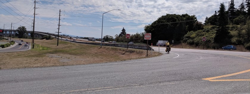
This ride has the potential to be low-stress, assuming you can find the trail the runs next to Highway 20. I failed to find the trail multiple consecutive years, despite abundant signs. The trail is easy to miss, because the entrance is hidden in an unexpected location. First, you get onto the trail on the north side of the street, against the flow of traffic. Second, there are Do Not Enter signs (for cars) right by the trail entrance, which might make you nervous about going that direction. Third, it’s not clear from the road that there actually is a trail there.
My advice is to follow the trail signs, and when it seems to dead-end right at a busy section on the north side of Highway 20, look east, cross the street, and walk to the north of the highway barrier.
- Follow the Adventure Cycling Washington Parks Section 1 route map to the end of the Tommy Thompson Trail.
- R March Point Rd
- L S March Point Rd
- L toward WA-20, R toward WA-20
- L WA-20
- R LaConnor Whitney Rd
- L McLean Rd
- L Wall St
- R W Division St
- L E Montgomery St
