
Overview
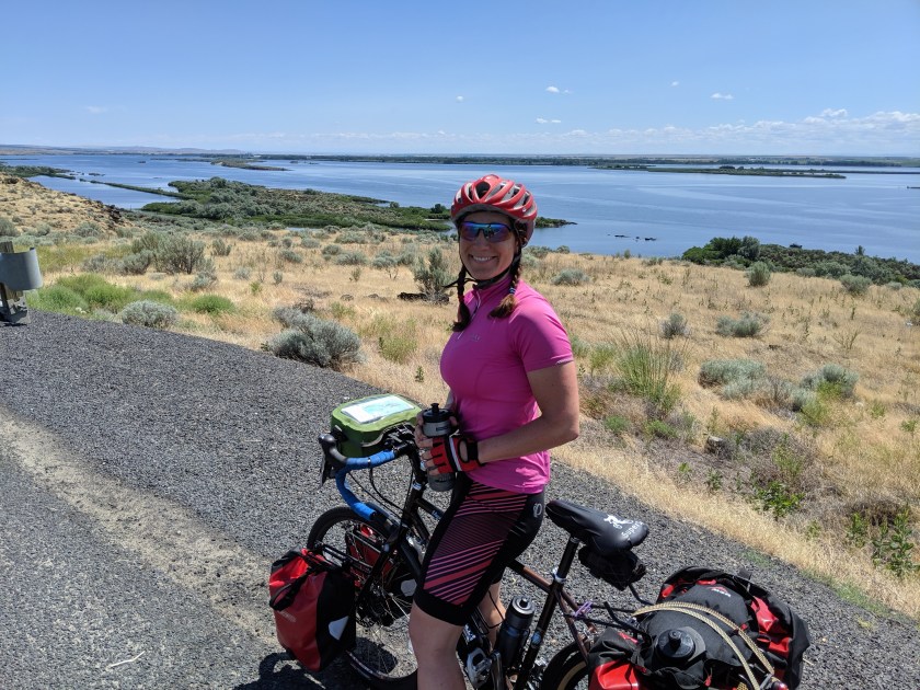
This route takes you on a spectacular ride along the Columbia River, through the gorge and into the scrub lands. Given that I didn’t see any other bike tourists on the trip, I can only conclude that this route is deeply under-appreciated. The first two days pass through a bunch of towns with plenty of services, followed by three days with very few towns and services, until you arrive in Walla Walla.
Because this ride is almost entirely flat, it makes for a nice change from riding through the mountains. However, the wind along the river can be powerful. To minimize headwinds, I rode the same direction as the prevailing winds: west to east. Though it might be tempting to go the other direction, I wouldn’t recommend it. Having a tailwind is a lot of fun, and the wind can be powerful enough that riding into it could make for a very difficult trip.
Even riding the same direction as the prevailing winds, there’s always a chance that you’ll end up with a headwind. For this reason, I avoided planning any very long days, and ultimately ended up riding about 60 miles every day except one.
This ride is best done during the shoulder seasons (May/June, September/October), because it takes you into regions that could get extremely hot in the summer. I did the ride the first week of July and had perfect weather. The temperature never got too high, and even on warm days, there was a nice breeze coming off the river.
Maps & Logistics

This route conveniently falls within Adventure Cycling’s Lewis & Clark Section 7 map. The map I had was a little old, and the bike trail along the river heading towards Hood River has been extended, so hopefully newer maps reflect that change. At two points, I had to ride on the highway, but the additional trail section meant less time spent on the highway. The two highways sections weren’t bad, though, because I had a tailwind both times, and the miles flew by.
To get to my start point in Portland, I took the Amtrak Cascades train. I spent that night in Portland and started the trip the next morning, but a more ambitious person could take an earlier train and start the ride right from the train station.
Leaving Walla Walla, I picked up a point-to-point rental car from Enterprise Rent-A-Car. I always reserve a mid-size SUV so that I can fit my bike flat in the back of the car. So far, Enterprise has always given me the car size that I requested or a larger car.
Itinerary
Day 1: Portland to Viento State Park
Day 2: Viento State Park to Maryhill State Park
Day 3: Maryhill State Park to Crow Butte Park
Day 4: Crow Butte Park to Umatilla
Day 5: Umatilla to Walla Walla
I planned this as a five day trip. Theoretically, you could do it in four days, with one very long day, but I worried that if I planned a long day, that would be the day I had a headwind. I was also somewhat limited by campground locations. I unexpectedly ended up with one very short, 33 mile day, after multiple people warned me against the RV park I had been planning to stay at outside of Umatilla.
Day 1: Portland to Viento State Park

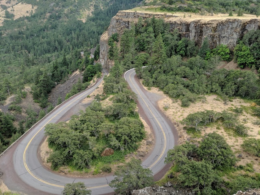
The trip starts with a ride out of Portland along a trail by the river. It is spectacular, and the rest of the day only gets more beautiful. The route takes you past Multnomah Falls, and then a bunch of other waterfalls that are also beautiful but curiously have fewer people visiting them. There are a couple of of hills, but they’re entirely manageable, and they end in really fun downhills. You do have to bike on the highway a bit, but less than my route map indicated, because they are actively adding bike trails next to the highway.
Distance
Approx. 65 miles
This day could be longer if you prefer not to camp, in which case you could ride onward to Hood River and stay in a hotel. It could also be a bit shorter if you decided to camp at Wyeth campground, which appears to be quieter than Viento State Park but lacks showers.
Food

- Lunch: I recommend stopping at the Troutdale General Store. It’s at just about the perfect mileage for a lunch stop, and the sandwich I had was delicious. They also had tables outside, so I could watch my bike while I ate.
- Dinner: Pick up groceries in Cascade Locks to cook at the campground.
- Bonus: Cascade Locks has a rather famous ice cream shop, the Eastwind Drive-in, that is a lovely place to stop. Multiple people told me about the giant ice cream cones.

Camping/Lodging
For the first night, you can decide where to stay based on your priorities. If you want showers, stay at Viento State Park. If you want quiet, stay at Wyeth campground, which is about five miles closer to Portland. If you want to stay indoors, bike a bit farther to Hood River, and stay in one of the hotels there.
The facilities at Viento State Park were very nice, but the website photos definitely make the park look nicer than it actually is. The highway runs through the middle of the campground, and the train tracks run along the side. Nevertheless, it was safe and had showers. Also, every campground along the river for this entire trip has train tracks nearby.
Day 2: Viento State Park to Maryhill State Park
After a very short ride, you arrive in Hood River, where you can have brunch and buy supplies for lunch. Towards the end of the day, you bike through the Dalles, which is the last gasp of civilization for almost two days. Be sure to buy supplies for the next two days while you’re there. The ride through the Dalles takes you on a bike trail along the river and not through town, so you’ll need to make a detour to get to town. After leaving the Dalles, the landscape gets pretty desolate, but in a good way. Be prepared to ride many miles without any services.
Distance
Approx. 60 miles
Food
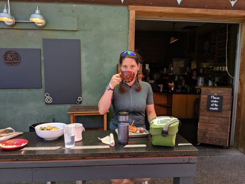
- In true Portland style, I had brunch in Hood River at Kickstand Coffee & Kitchen. As an added bonus, the restaurant is next door to and/or affiliated with a bike shop.
- I also stopped at the Safeway in Hood River to pick up some snacks for lunch.
- I also stopped at the Safeway in the Dalles to pick up food for the next two days: two dinners and two lunches.
Camping
By the time you get to Maryhill State Park, you have left civilization behind. Though there is a small town on the south side of the river, it is very small and doesn’t look like it’s doing great. There is a small fruit stand near the park, where I picked up a bag of cherries. When I was there, the fruit stand closed at 6 PM.
The campground has two hiker/biker sites, which the camp host was very excited to show me. The sites were pretty nice and located near the RV area, which meant I basically had the bathroom to myself. I met a lot of friendly people and felt very safe. The one downside to this campground is the earwigs, of which there are many. When I woke up in the morning, I found the clothes I had left out to dry were covered in earwigs. For the rest of the trip, I continued to find earwigs in surprising places. I fully expect that I will continue to find earwigs for some time to come.
Another camping option is the Deschutes River State Recreation Area, which is located 5.5 miles prior to Maryhill State Park on the Oregon side of the river.
Day 3: Maryhill State Park to Crow Butte Park
I always get nervous when I know there won’t be any towns for a long stretch, but those rides are also often some of the most beautiful. Such was the case with this ride, which was about 60 miles of river and canyon and not much else. You do pass through the very small town of Roosevelt towards the end of the day, which is a nice place to buy Gatorade and ice cream. The map indicates that there is a restaurant and a store, but really there’s a restaurant/store that’s not really much of either. This is a good day to fill up the dromedary, because there isn’t anywhere to get water until Roosevelt. The day ends at Crow Butte Park, which was the nicest of the parks that I stayed at on this trip, though the many, many signs warning of rattlesnakes did make me nervous.
Distance
Approx. 60 miles
Food

- Lunch: Not only isn’t there anywhere to buy food on this route, but there also isn’t a particularly good place to stop to eat the food that you (hopefully) bought the previous day. I ended up pulling over to the side of the road at a spot that had a few rocks that I could sit on.
- Dinner: Cook the food that you bought at the grocery store in the Dalles the previous day. If you’re lucky, the fruit stand will still be open when you arrive, and you can buy some fresh fruit. I would not count on the fruit stand being open, though.
- In a pinch, you could pick up some supplies in Roosevelt. I didn’t see any fresh produce at the store, but you could certainly find something that you could cook at camp.
Camping
This campground was my favorite of the trip. The bathrooms have showers, and you can get a campsite right on the river. There’s a walking trail, but because of all the signs warning about rattlesnakes and the fact that I only had sandals, I chose not to try it. The camp host said that they had only seen one rattlesnake in the campground so far that year, but that if you went on the walking trail, you would see at least one.
Day 4: Crow Butte Park to Umatilla
I planned a rather short 40 mile ride for this day due to campground locations, and ended up doing an even shorter 33 mile ride due to multiple warnings against the RV park where I had been planning to camp. The ride is pretty, though you are a bit far from the river for sections of it, and after about 30 miles you get to Umatilla, which is a real town with a grocery store.
Distance
Approx. 33 miles
Food
- Lunch: Eat the food you bought in the Dalles.
- Dinner: Buy food in Umatilla to cook at camp, and pick up food to eat for lunch on Day 5.
Camping
This section of the route does not have many camping options, and none were located far enough from the previous night, in my opinion. My first plan was to stay at Hat Rock Campground, which is a private RV park that has tent camping sites. After two separate people warned me not to stay there, I decided I should listen to their advice. I’m not really sure why they advised against staying there. It sounds like most of the RV campers at that park live there permanently, though I’m not sure why that would be a problem. When I biked past the road to that campground, what stood out to me was how isolated the park is. If it turns out not to be a nice place to stay, there is nothing else around it, and nowhere else to go.
With not many other options, I ended up at the Umatilla Marina & RV Park. The campground was lovely and safe. I find it hard to have such a short day of riding, but the campground is next to the McNary Wildlife Nature Area, which has walking trails, and the McNary dam, which you can visit. Even though the campground is right next to the town, it felt completely safe.
If you want to stay indoors, Umatilla also has some hotels.

Not recommended
The Sand Station Recreation Area, just past the Hat Rock Campground, used to have camping, but doesn’t anymore. It also doesn’t have any water. When I went past it, despite multiple No Camping signs, people were clearly camping there. The lack of water seems like a deal breaker, though, because the ride the next day doesn’t have any place to get water until Touchet, which is 40 miles from Umatilla.
Farther down the route towards Walla Walla, you go past Pierce’s Green Valley RV Park. I considered making this a longer day and heading to this RV park, until I read the online reviews, which are possibly the worst campground reviews I have ever seen. It seems best to avoid this RV park.
Day 5: Umatilla to Walla Walla

After such a short ride the previous day, I was feeling restless and wanted to start today’s ride early. Also, the temperature was climbing, and I thought it would be a good idea to leave before it got too hot. What I didn’t realize is that after Umatilla, there are no services until Touchet. That means no water for 40 miles. I recommend putting at least a little extra water in your dromedary. If your bike holds three water bottles, you might be fine. You should also make sure to pick up some snacks or food for lunch in Umatilla. Once you reach Walla Walla, you can either spend the night there, or pick up a rental car immediately and start your drive home.
Distance
Approx. 60 miles, depending where in Walla Walla your ride ends.
Food
- Be sure to get water and snacks/lunch in Umatilla before heading out for the day.
- Forty miles into the ride, you reach Touchet, which has fruit stands and a very impressive gas station store. I snacked in the morning and then had a delicious wrap at the gas station.
- The day ends in Walla Walla, where you have endless food options. I really enjoyed Wingman Birdz + Brewz.
Lodging
Walla Walla is a big enough city that it’s not a good place to camp, nor are there many nearby campgrounds. There are some standard hotels that didn’t seem horribly expensive. I stayed at the Inn at Blackberry Creek, which is a B&B in a gorgeous old house.
